
On Monday 6th May I spent the day with Peter Cunningham and Jeremy Fenton. We walked along a nature trail in the area around Charlestown and An Ard, just south of Gairloch, an area Peter claimed as a biodiversity hotspot in Wester Ross – I was to be in for a treat!

The walk is around 4km, and should take around 2 hours, although we took a little longer because I kept stopping to ask frequent questions and take too many pictures. We walked through 8 zones, each with it’s own range of habitats. This map, courtesy of Peter, details these zones:

The whole experience mimics exactly what I would like to do more with pupils on S3 Projects. Go for a walk, not simple for exercise, or to reach a destination, but to explore, observe and learn about the biodiversity, or lack thereof, wherever we are located.
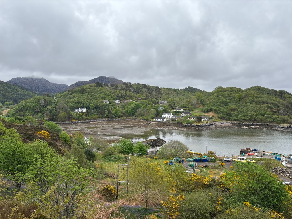
Zone 1 – Estuary and Harbour
Even before starting the walk, there were lots of things to see in the harbour. We looked across the harbour toward the Gneiss Rock, which Jeremy tells me is the oldest rock in Scotland and Western Europe, at 3 billion years old. Interestingly the rock on our side of the harbour is Amphibolite rock formed by metamorphism of basalt, and is apparently 2 billion years old. I’ve so much to learn about rock – back in 1996 Higher Geography wasn’t my thing – but today for whatever reason I’m much more curious. Jeremy is a local expert, and has published a booklet on the geology of the region that can be purchased at the Gairloch Museum – you can also download a free pdf copy here or find a good one page summary on his site here.

The Flowerdale burn flows from lochs hidden within the hills beyond Gairloch, and the estuary has abundant wildlife to observe. We were able to spot a Great Northern Diver (also known as a common loon), a common sandpiper and a grasshopper wobbler. Once again, Jeremy has produced a booklet on the wildlife of Wester Ross that can be downloaded from his website or purchased from the museum.
When the tide is out, a whole host of wildlife can be spotted, if you know what you are looking for…curlew, oystercatchers and gulls, feeding on creatures living in the seaweed, such as prawns and winkles. And when the tide is in it brings a vast range of fish and crabs with it, bringing even more birds, like herons, cormorants and terns in the summer.
Zone 2 – Native trees
From Pier Road at the harbour, we took the path immediately behind Peter’s office and entered an area with mostly native trees, although some invasive species thrive here too. This is despite enthusiastic volunteers like GWC Project groups coming along to remove the Rhododendron Ponticum from time to time.


I was able to identity aspen, oak, rowan, birch, scot’s pine and willow (see photo gallery below). These are important native tree species which have grown in this part of Scotland for many thousands of years. Many of the trees have mosses and lichens on them; a fragment of what is now called ‘Scotland’s temperate rainforest’. More on this in a later post.

There was also plenty holly, ivy, honeysuckle, brambles, bracken, blaeberry and non-native and invasive Gunnera (spread from Inverewe gardens) and Rhododendron ponticum.


Zone 3 – Heathland
Leaving the woodland, the path turns west into an area with mosses, heathers, bog myrtle and grasses. The ancient rock in Wester Ross does not break down easily into mineral soil. Instead, peaty soils have been formed by mosses and other plants. The soils on high ground of Wester Ross has been worn away by erosion, in part due to overgrazing, trampling, wildfires and heavy rainfall.
Some photos from this zone:


Zone 4 – The shore
From the viewpoint, standing on gneiss rock we overlooked the shore, where we could spot seabirds and where there is always the possibility of sighting a whale. Though not today!

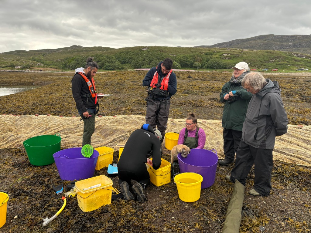
From there, the path turns right, through coastal birchwood, over a board walk, and emerges by the shore at the west end of Gairloch beach. We spotted one family fishing for shell fish, perhaps to prepare for selling at a local restaurant. To the trained eye there is lots to see and identify here, including many animals that live in the sand and provide food for birds, not to mention crabs and fish when the tide comes in. There are a range of varieties of seaweed on the rocky headland, and at low tide a sheltered lagoon that would be good for snorkling, so Peter tells me.
Here’s what we spotted…


Zone 5 -Coast and dunes & Zone 6 – Stones and cemetery
As time was marching on, we past by these two zones rather quickly. But not without having a quick geology lesson from Jeremy. We examined the Gneiss, a particular terrane called Ialltaig (a terrane is a large section of the crust which has the same geological history), observed vertical layers of foliation of Amphibolite rock, and admired a unconformity, a join between Loch Maree Group Ard (Augen) Gneiss and very coarse Torridonian sandstone called Diabaig breccia. You can read much more about all these things in Jeremy’s booklet on the geology of Wester Ross found here.


There are many wild plants along the dunes; vetches, wild roses and small sycamore trees, along with plenty of bracken. As we walked along the path from beach to golf course to car park, there were several elm and cherry trees, along with mosses and lichens in the stone wall. From here we headed to our next zone…
Zone 7: woodland
The nature trail crosses the main road that leads into Gairloch. Walking through a gate in a deer fence, two paths lead toward the Flowerdale arboretum. We walked through mostly non-native conifers, such as Douglas fir and spruce. It is a beautiful woodland.
Peter tells me about bird waves. Several species work together and call to each other for safety. In April and May, the warblers arrive. Peter can identify all the birds just by their song. I’m still relying on the fantastic Merlin app, but it’s only a matter of time!!


Peter tells me that Dutch elm disease, a fungi spread by beetles, is a big problem for the larch trees in this forest and around Inverewe.
Zone 8: freshwater
The path through the conifers leads to the main drive of Flowerdale House, joining the path to the waterfall. The route back to the start of the nature trail passes a range of habitats; marshes, shallow and deeper ponds. There is a good chance of seeing frogs, toads and newts, along with dragonfly larvae and water beetles. Of interest to me, and possibly any young person on S3 Projects, is the hemlock water dropwort, the UK’s most poisonous plant. How curious that it grows here…probably best not to point it out to students??


Scratching the surface
The 3 hours walking around this trail taught me one vital lesson. The goal of the walk is not the destination, but the walk itself. Up until this point in my life, walking, especially in the hills, was all about the destination. Get to the mountain top. Yes, enjoy the views on the way, but rarely did I stop and observe. Perhaps the same goes for longer journeys. I drive a Ford!
But the focus of my walks from now on will be to slow down, observe and learn.
Peter has great plans for this nature trail. And so he should. Each zone has multiple habitats containing a vast array of life. Whether by walking boot, wellies, or even wetsuit and snorkel gear, there is so much to value, protect and enhance in this beautiful trail. I am no expert, but I’ve learned today a bit more about how to look and what to look for. Jeremy’s books are invaluable as a guide too, and I referred to them frequently when writing this post. Please do let me know if you spot any inaccuracies.


Leave a comment